
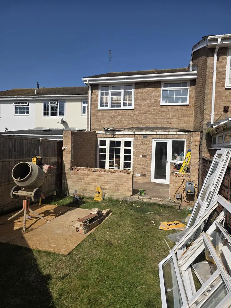
Building an extension on the West Sussex coast is mostly about three things: flood risk, the ground, and the salt air. If your house is in Environment Agency Flood Zone 2 or 3 — as parts of Pagham, Bognor Regis, Middleton-on-Sea, Littlehampton and Selsey are — a planning application or prior approval needs a short flood risk assessment, and the Environment Agency now recommends new floors at least 600mm above the estimated flood level, or extra flood-resilience measures where that is not possible. Below ground, the coastal plain is a mix of silt, gravel and shrinkable clay with high winter groundwater, so foundations are designed after a trial hole, not before. Above ground, stainless fixings and coastal-rated finishes are what stop the job being redone in five years.
Almost all of our work is on this stretch of coast. None of what follows is a reason not to build here. It is a reason to price the footings after looking at the ground, and to think about water at the drawing stage rather than the first wet winter.
Flood zones: check your address first
The Environment Agency's Flood Map for Planning places every address in one of three zones. Zone 1 is low probability of flooding from rivers or the sea; Zone 2 medium; Zone 3 high. It takes a minute to check and it is the first thing to do.
Two things about the map surprise people:
- The zones ignore flood defences. A house behind a sea wall can still be in Flood Zone 3, because the map shows what would happen without the defence.
- Flood Zone 1 does not mean no flood risk. The zones are about rivers and the sea. Surface water and groundwater are separate risks, and on the coastal plain they are real ones — in January 2023 heavy rain on a high water table closed Pagham Road and Lower Bognor Road.
Arun District Council published a new Strategic Flood Risk Assessment, with a final report dated March 2026, replacing the 2016 version, with groundwater mapping and updated climate change data. It covers Arun outside the National Park. Chichester District Council has its own. Responsibility is split: the Environment Agency deals with the sea and main rivers; West Sussex County Council with surface water, groundwater and the rifes; Arun with planning and coastal erosion.
Do you need a flood risk assessment for an extension?
If your house is in Flood Zone 2 or 3 and the extension needs a planning application, the council will expect a flood risk assessment with it. (The larger home extension prior approval route is judged only on the neighbours' amenity, so it does not need one — but the floor-level advice below is still worth following.) For a householder extension it is short and proportionate, following the Environment Agency's standing advice for minor extensions. It covers:
- the site and what is proposed;
- the estimated flood level, including an allowance for climate change;
- the finished floor levels of the extension, measured against Ordnance Datum;
- the flood resistance and resilience measures to be used, shown on the drawings.
Floor levels: the advice changed in May 2026
The Environment Agency updated its standing advice on 28 May 2026. It now recommends that floor levels are at least 600mm above the estimated flood level, with flood-resistant construction up to at least that height — reducible to 300mm where the flood level is known with high certainty. Where floors cannot be raised, extra flood resistance and resilience measures are needed instead. Older guides, and plenty of websites, still say an extension's floor can simply be no lower than the existing house. That option is no longer in the current advice, so check the live page when the drawings are being done.
Raising an extension floor above the house floor has knock-on effects: a step at the knock-through, door thresholds, and roof heights against the permitted development limits. Resilience measures are the usual alternative where a step is unacceptable — water-resistant floor and wall finishes, raised sockets, non-return valves on drains, flood doors or barriers.
Other permissions near water
Work within 20m of a main river, a flood defence or a flow-control structure may need a flood risk activity permit from the Environment Agency, and work affecting a rife or ditch may need consent from West Sussex County Council. Planning permission does not cover either.
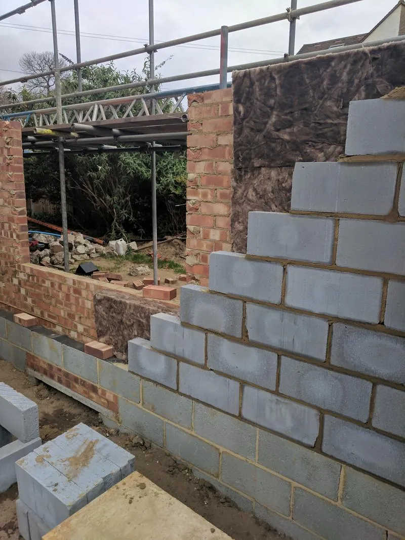
Pagham, the beach estates and coastal change
Pagham is where the coast decides most. The low land around the harbour lies largely in Flood Zones 2 and 3, and the rifes back up when the tidal outfalls close. Arun applies extra scrutiny to anything on the Pagham Beach Estate because of the coastal processes along it; it adopted an interim development framework for the estate in October 2021 and has been looking at a Coastal Change Management Area. It also states plainly that neither the council nor the Environment Agency has a duty to protect the coast from erosion or flooding.
Pagham Harbour itself is a Ramsar site, a Special Protection Area and a Site of Special Scientific Interest. It is not a National Landscape, so it does not switch off ordinary permitted development, but the larger home extension route is not available on SSSI land. Around Chichester Harbour, the National Landscape designation does reduce permitted development, and the Chichester Harbour Conservancy is consulted on applications there, with particular attention to dark skies — large glazing and rooflights can be questioned.
The ground under the coastal plain
The British Geological Survey's description of the Chichester and Bognor area explains why foundations here vary so much from one plot to the next:
- Brickearth — a fine wind-blown silt — covers much of the plain, usually under 2m thick.
- Raised beach gravels up to about 4m thick lie around Bognor Regis, Pagham and Selsey, with flint shingle along the present beaches.
- Head gravel, flint in clay, is thick along a buried former cliff line on the northern plain, which can mean the ground changes abruptly across a single site.
- Alluvium and tidal deposits — soft silty clays and organic muds — around Chichester and Pagham harbours and in the Arun valley at Littlehampton, along with made ground on reclaimed land.
- London Clay beneath much of the coast between Bognor and Pagham, which shrinks and swells with moisture and can be sulphate-bearing. Chalk lies deeper, and is exposed at Felpham.
In practice that means silt over gravel over clay, perched water where the silt sits on clay, and winter water tables close to the surface. Trenches may need pumping. Concrete may need to resist sulphates where tests show it. And a footing priced at one depth may need to go deeper once the trench is open.
Clay and trees: how deep the foundations go
On shrinkable clay, trees matter — the ones there now, and the ones recently felled, whose roots no longer draw water so the clay swells back. Foundation depths near trees follow published guidance (NHBC Chapter 4.2 and the LABC Warranty manual use the same framework), based on how shrinkable the clay is, the tree species and its distance:
| Clay volume change potential | Minimum depth |
|---|---|
| Low | 0.75m |
| Medium | 0.9m |
| High (or not known) | 1.0m |
Source: LABC Warranty Technical Manual, section 3: foundations.
Near trees those depths increase. Beyond about 1.5m, heave protection is needed against the sides of the foundation; beyond 2.5m the foundation has to be designed by a structural engineer, and with clay and trees that usually means piles and ground beams. That is why our quotations price foundations against a stated assumed depth, and the figure moves to match the depth actually reached once the trial holes are dug — up or down.
Rainwater and drainage
A new extension roof and a terrace send a lot of water somewhere. Soakaways only work where the ground drains, which on clay or with a high water table it often does not; infiltration tests settle it. Arun publishes supplementary requirements for surface water, including infiltration testing and groundwater monitoring. Where a soakaway will not work, the alternatives are attenuation and a controlled connection, agreed with Building Control. Shared drains at the back of older terraces and semis are often now public sewers, which brings in Southern Water's build-over rules — see extension costs.
Salt air and the materials that last
On a seafront elevation, the fixings decide how long a finish lasts. There is no single regulation that lists coastal specifications, but the good practice we follow on the front at Felpham, Aldwick, Middleton-on-Sea and Bognor Regis is:
- Stainless steel wall ties, restraint straps and fixings — marine-grade where exposed — rather than galvanised, which corrodes faster in salt air.
- Powder-coated aluminium windows, bifolds and lanterns with a coastal or "seaside" finish, and an understanding of the supplier's warranty conditions, which often require periodic washing down.
- Render systems with mesh and a silicone finish specified for severe exposure to wind-driven rain.
- Marine-grade sealants and pointing suited to the exposure.
- No untreated mild steel anywhere it can see the weather.
Get it wrong and you are back at the house in three years. On the Summerley Estate in Felpham, where we built a first-floor extension with a seaward glass balcony, the glass was lifted with one eye on the wind, and the specification was written for the frontage it faces.
Does building near the coast cost more?
Sometimes, and almost always below ground: deeper or engineered foundations, trench pumping, sulphate-resisting concrete, land drainage, and on the beach estates the logistics of weight limits and restricted hours. Above ground, coastal-rated fixings and finishes cost a little more than standard and save a great deal. Against that, wider roads and drives in the suburbs of Bognor and Felpham often make access cheaper than in a city centre. Our price guide bands are the same across our area; what changes is where in the band a job lands.
Questions people ask about building near the coast
Is Bognor Regis in a flood zone?
Parts of it are, as are parts of Pagham, Felpham, Middleton-on-Sea and Littlehampton; much of the town is not. Check the specific address on the Environment Agency's Flood Map for Planning, and remember the zones ignore sea defences and do not show surface water or groundwater risk.
Do I need a flood risk assessment for a house extension?
If the house is in Flood Zone 2 or 3 and the extension needs a planning application, yes. For a householder extension it is a short assessment following the Environment Agency's standing advice for minor extensions.
What floor level does an extension in a flood zone need?
Since May 2026 the Environment Agency recommends floors at least 600mm above the estimated flood level, or 300mm where the level is known with high certainty. Where that is not possible, extra flood resistance and resilience measures are needed.
What is the ground like in Bognor Regis for foundations?
Variable: wind-blown silt over beach gravels over London Clay in many places, with high winter groundwater. Some of the clay shrinks and swells. A trial hole decides the foundation depth.
How deep do foundations need to be near trees on clay?
At least 0.75m to 1.0m depending on how shrinkable the clay is, and deeper near trees according to species and distance. Beyond 2.5m an engineer designs the foundation, usually with piles.
What wall ties should be used near the sea?
Stainless steel ties and fixings rather than galvanised, which corrode faster in salt-laden air. Coastal-rated finishes on windows and doors are the other half of the same decision.
Do I need Environment Agency permission to build near the sea wall?
Work within 20m of a main river, flood defence or flow-control structure may need a flood risk activity permit from the Environment Agency, separate from planning permission. Work affecting a rife or ditch may need consent from West Sussex County Council.
Does Pagham flood?
Low-lying parts around the harbour lie in Flood Zones 2 and 3, the rifes can back up when the tidal outfalls are shut, and surface and groundwater flooding has closed roads in heavy rain. Arun applies extra scrutiny on the Pagham Beach Estate.
Where these facts come from
- Environment Agency: flood risk assessment standing advice (updated May 2026).
- Environment Agency: Flood Map for Planning.
- Arun District Council: flood risk and the 2026 Strategic Flood Risk Assessment.
- British Geological Survey: Chichester and Bognor sheet explanation.
- LABC Warranty Technical Manual: foundations.
- Chichester Harbour Conservancy: planning.
Price match guarantee

We will never compromise on quality but we will match any like-for-like price.
The words doing the work there are like-for-like. A quotation that comes in cheaper is usually describing a different job underneath. A shallower footing. A thinner unit of glass behind the same three words. Making good dropped, so the decorating lands back on you at the worst possible moment. A scaffold nobody priced, arriving in week three as an extra.
None of that makes the other builder a crook. It makes the two pieces of paper impossible to compare until somebody opens them both up, which is the whole reason ours arrives as over two hundred itemised lines rather than a figure at the bottom of a page.
So bring the other quotation to the site visit and we will go through it against ours, line for line. Either your price gets matched, or you find out what the cheaper number quietly leaves out — and either of those is worth an hour.
Read the price match guarantee terms — what counts as like-for-like, how long a match holds good, and why one builder's total can sit a fifth below another's before anybody has lifted a tool.
Related guides
How much does a rear extension cost per square metre in West Sussex?
Our £2,400–£3,600 per m² band explained with a real 50m² Bognor Regis job, national figures, what the rate excludes, glazing, and Southern Water build-over costs.
Read the guideDo you need planning permission for a rear extension?
Permitted development depths and heights, the larger home extension route, two-storey and side extensions, conservation areas, fees and what the neighbours can say.
Read the guideParty wall agreements explained for homeowners
The three kinds of work that need a notice, the notice periods, the 3m and 6m rules, what happens if the neighbour says no, surveyors' fees and who pays.
Read the guideNext step
If the drawings exist, send them and a priced quotation comes back. If they do not, the site visit is the way to find out whether the job can be done at all.
Or the landline on 01243 256796, or WhatsApp if it is easier to send a photograph. Reply within one working day, every time.